


VERNON 265 Voting District, Lake County, Illinois
About
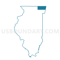
Outline

Summary
| Unique Area Identifier | 572028 |
| Name | VERNON 265 Voting District |
| County | Lake County |
| State | Illinois |
| Area (square miles) | 0.18 |
| Land Area (square miles) | 0.18 |
| Water Area (square miles) | 0.00 |
| % of Land Area | 100.00 |
| % of Water Area | 0.00 |
| Latitude of the Internal Point | 42.22142010 |
| Longtitude of the Internal Point | -87.98436660 |
Maps


Graphs
Select a template below for downloading or customizing gragh for VERNON 265 Voting District, Lake County, Illinois


Neighbors
Neighoring Voting District (by Name) Neighboring Voting District on the Map
- VERNON 256 Voting District, Lake County, IL
- VERNON 262 Voting District, Lake County, IL
- VERNON 263 Voting District, Lake County, IL
- VERNON 264 Voting District, Lake County, IL
- VERNON 266 Voting District, Lake County, IL
Top 10 Neighboring County Subdivision (by Population) Neighboring County Subdivision on the Map
Top 10 Neighboring Place (by Population) Neighboring Place on the Map
Top 10 Neighboring Elementary School District (by Population) Neighboring Elementary School District on the Map
- Hawthorn Community Consolidated School District 73, IL (29,650)
- Kildeer Countryside Community Consolidated School District 96, IL (23,683)
Top 10 Neighboring Secondary School District (by Population) Neighboring Secondary School District on the Map
- Adlai E. Stevenson High School District 125, IL (61,187)
- Libertyville Community High School District 128, IL (49,926)
- Mundelein Consolidated High School District 120, IL (42,836)